Our Travel blog
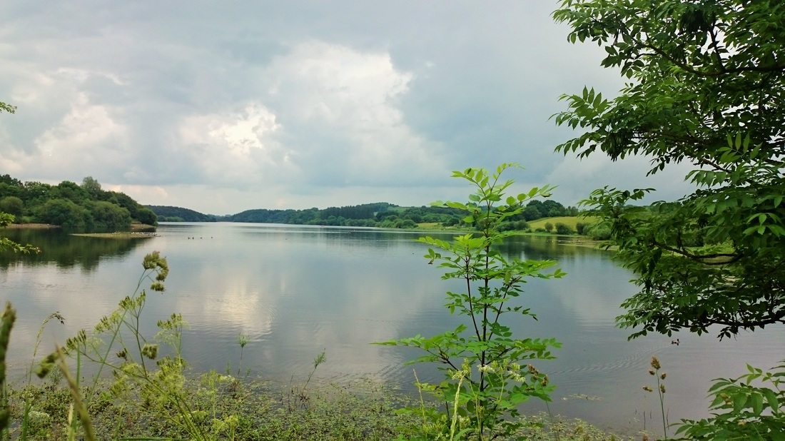
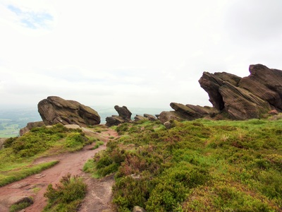
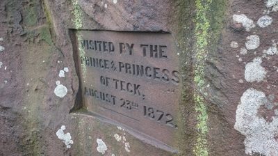
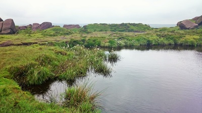
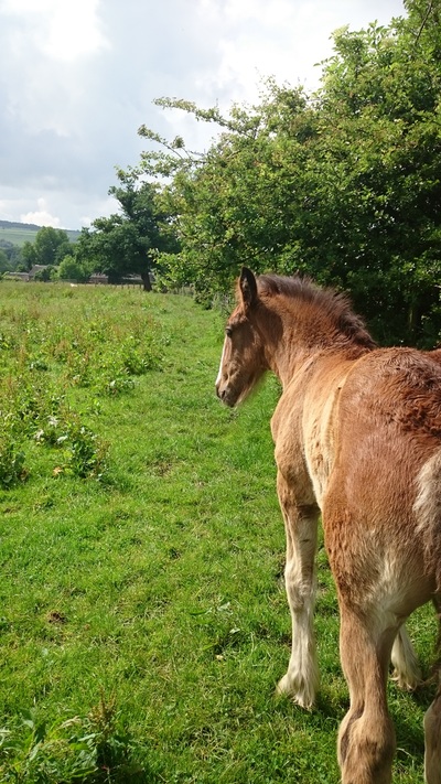
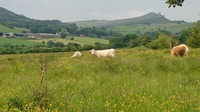
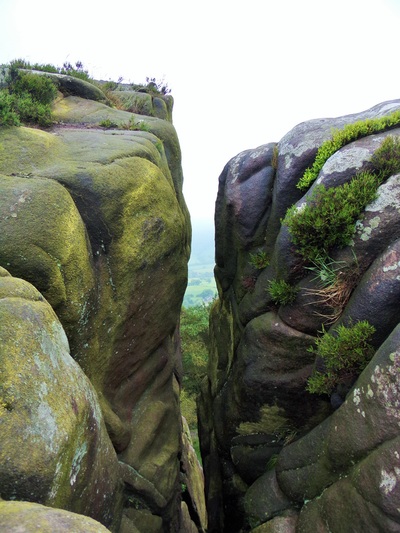
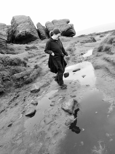
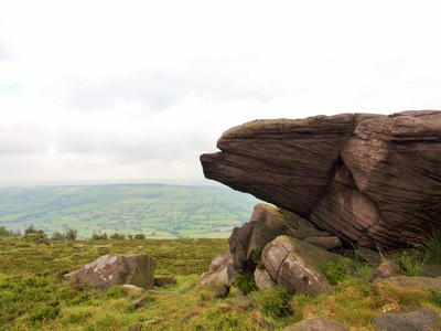
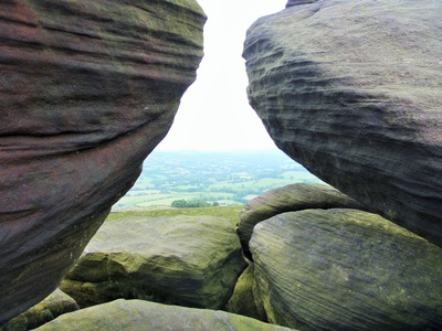
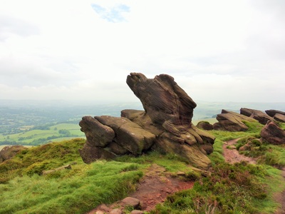
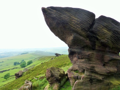
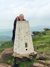 We set out from the site in the late morning to climb The Roaches. Well, climb is a bit of an exaggeration, we intended to follow the footpath up where only thousands have been before, but the incline was steep and rugged and our attire was of the sort favoured by serious hikers and had lots of pockets; I may even have attached a small carabiner. It felt to us like an expedition. We started walking in steady moderate rain, of the sort that quickly penetrates everything. Turning off the main road just before Upper Hulme we followed a stream down to a footbridge of worn stone then up through dank long grass to join a minor road from which our route branched off a mile so so later. We took to open access land and up the first ascent of the day, Hen Cloud. Halfway up the steep path we met notices alerting walkers to keep to the path and not venture left because of nesting Peregrine Falcons. Intrigued, we elected to head back down and investigate the shed where Staffordshire Wildlife Trust volunteers stood vigil over the nest, per chance to discover more. While Alison was viewing the falcon through their powerful scope I was being talked at about map reading. I love maps so at first I thought I had met a kindred spirit as we discussed the merits of OS mapping, but his devotion led him to regale me with tales of him finding lost people, guiding parties to safety from certain doom, or at least from being mildly inconvenienced, and how he'd print his maps and laminate them...at least I think that's correct. Frankly I tuned out and let him carry on while I fantasised about chopping him up and feeding him to the falcons, wondered how England would get on in the football and then composed this blog entry in my head while he droned on. I silently hoped he wasn't about to set an exam to test my knowledge of his orienteering prowess. Alison eventually tired of bird spotting and roused me from my semi comatose state and we went on our way. I chanced a look back and my erstwhile OS superhero was gesticulating to thin air, probably pointing out where he had saved a party of nuns from plunging into a disused mine shaft because they were using the wrong scale OS or some-such inflated nonsense. I'm not sure he realised I'd left and was now cheerfully half a mile away, making good headway up the path towards the lower tier of The Roaches. The path ran below the jagged edge of The Roaches, beloved of rock climbers, and weaved along the top of a delightful wooded area, heavily populated with pines that lent it an Alpine air. The feeling of being able to reach out and touch the top of a mighty pine tree was uncanny as we walked on, closer now to the edge as the path narrowed. The rain had abated and everything was fresh and green as we rounded an outcrop and met the rock steps leading to the upper tier. From the top of the steps we could see Tittesworth reservoir, grey and murky at first then bright and silver among the greenery as the sun came out in the valley. Above the reservoir Gun Hill was half illuminated by sunlight struggling through low grey cloud, the patchwork of irregular fields split by deep green hedges, in contrast to the dry stone walls around us. We discovered a rough seat hewn into a rock, poised precariously above a sheer drop and above it a plaque, carved into the rock, commemorating the visit to this very spot of the Prince and Princess of Teck on Aug 23rd 1872. We had no idea who the heck the Prince and Princess of Teck were but subsequent research revealed that the Prince was a minor German aristocrat and the Princess was Mary Adelaide, cousin of Queen Victoria, who was still unmarried at the ripe old age the age of 30. Being the way of things a match was sought with someone of suitable royal blood. Reports also mention her lack of income, advanced age and rather uncharitably 'lack of attractiveness' as contributing factors, but somehow they unearthed Prince Francis, Prince of Teck in Württemberg. The Prince was of lower rank than Mary and had no succession rights to the throne of Württemberg but nevertheless they were married on 12 June 1866 in Surrey. In 1883 they had to flee England to escape debts, but on their return in 1885 Mary began devoting her life to the twin causes of charity and getting her daughter married into royalty. She finally managed to marry Princess Victoria Mary of Teck (known as May) to Prince George, Duke of York, who was to become George V. It was her second attempt, the first was to his brother The Duke of Clarence who inconveniently died six weeks after the betrothal. So, there you go. Pictures of the time show a jolly party crowded onto the rocks to take in the views. Today though we appeared to have them to ourselves as we took the ridge path along the top and made our way along sandy paths, scrambled over rocks worn smooth and shiny by countless walking boots, passed the lonely dark waters of the tiny Doxy Pool, through dark peaty mud and on to the trig point that marked the summit of our walk, at 505 somethings. Metres I believe. I had the strange experience of attending primary school when the country adopted decimalisation, along with selective bits of the metric system. In theory this should make me adept at understanding both imperial and metric measurements but in fact I understand neither. Alison kindly translates things like weather forecasts for me since having once told me the temperature would be around 55 I presented myself in shorts and tee shirt to be met by a familiar look of resignation and was gently escorted upstairs to put on clothing more suitable for 55 Fahrenheit, hat gloves scarf etcetea, rather than the 55 Celsius I'd prepared for. Anyway, from our lofty position at 505 gallons below sea level or something, we could survey the panorama around us. The broad valleys, low hills creeping up to purple and golden moors, verdant wooded hills towards Flash, England's highest village, to our North, the arrow straight Roman road of the A53 cutting between the open farmland and moors to the East and more rugged terrain crested by the Roaches we were standing upon. Below us were the Ramshaw Rocks, looking as if they had been swept upwards in the manner of sand as the tide recedes, left to dry as exposed and windswept monuments to the seismic events that formed them. From here we descended rapidly to stony outcrops and an alien landscape of peculiar weather sculpted rocks at Bearstone Rock. We've no idea which was Bearstone Rock because the area had many that could qualify as local landmarks. The views back into the Five Clouds valley that sits to the West under The Roaches stretched all the way to the Tittesworth Reservoir and the village of Meerbrook, hidden except for the church spire and chimneys poking out from the trees. The sun continued to tease us by shining on the hills around and away from the wind we stripped off layers as the air became still and muggy under the cloud. Walking down the last of the path we joined a minor road and set off back under the cliff face of Roach End, beneath the rocks and then dropped down a steep side road to Roche Grange. We were going to cut through on footpaths to Meerbrook but they were mostly overgrown and uninviting, especially since the sun was now out, making the still air buzz with insects that stuck to our skin. We eventually found a suitable path and struck off through fields of open meadows resplendent in vivid yellow buttercups and flanked by willows, hawthorn hedges and lone trees. About to enter one such field a frisky foal spied us, whinnied and darted over on spindly legs. It seemed delighted to have human company and bounced about like a dog eager for a game. It's mother looked up and with slight shrug of resignation returned to grazing, I suspect secretly pleased to have him off her hands for a while. Lovely though it was to be greeted so enthusiastically he worried us in his playfulness. We'd made progress across the field when he galloped up from behind, touched my shoulder and turned away with a flick of hooves and a deep, resonant fart. A nearby cow gave us a 'kids, what can you do?' look and resumed chomping her way through the long grass. We hurried on and fortunately he lost interest as we descended to cross a stream flowing towards the river Churnet. We joined the Staffordshire Moorlands Walks way-marked route which led us through another field of thankfully more placid horses and into Meerbrook and the snug Lazy Trout pub where we took liquid refreshments. The final section of our walk took us along the road, crossing the reservoir and headed uphill, dodging traffic until we met the A53 and the short walk back to the site. In all we covered around 12 miles of undulating countryside and rewarded ourselves with cups of tea, prolonged warm showers and a hearty meal at the nearby pub and restaurant. A fine days walking in a part of the world that we are gradually adopting as our own.
3 Comments
Ro
6/23/2016 10:41:40 pm
Love reading your blog you two and looking forward to catching uppity you at the weekend. Hope the blog about camping is complimentary to us all!
Reply
Ray Canham
6/24/2016 11:34:54 am
Hi Ro. Thank you, we're looking forward to meeting up. We do seem to be making people insecure but rest assured nothing but nice things will be reported. :)
Reply
karen
6/25/2016 08:31:57 pm
lovely photos, beginning to wish i had used Wembley now as its quite a challenge adding photos to wordpress. enjoy anyway. great reading as always
Reply
Leave a Reply. |
IntroductionThank you for stopping by and reading our blog. If you don’t know who we are, what we are doing and you're wondering what this is all about you can read up on our project here. Archives
November 2017
Categories |
 RSS Feed
